Currently piloting in selected US cities:
mapping tree canopy to increase tree coverage and improve urban ecosystems.
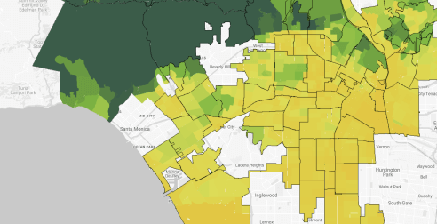
Explore tree canopy from city scale to street level
Explore tree canopy from city scale to street level
Google is mapping tree canopy coverage using aerial imagery in cities. Tree coverage varies across neighborhoods and developing an understanding of tree locations can inform and inspire action.
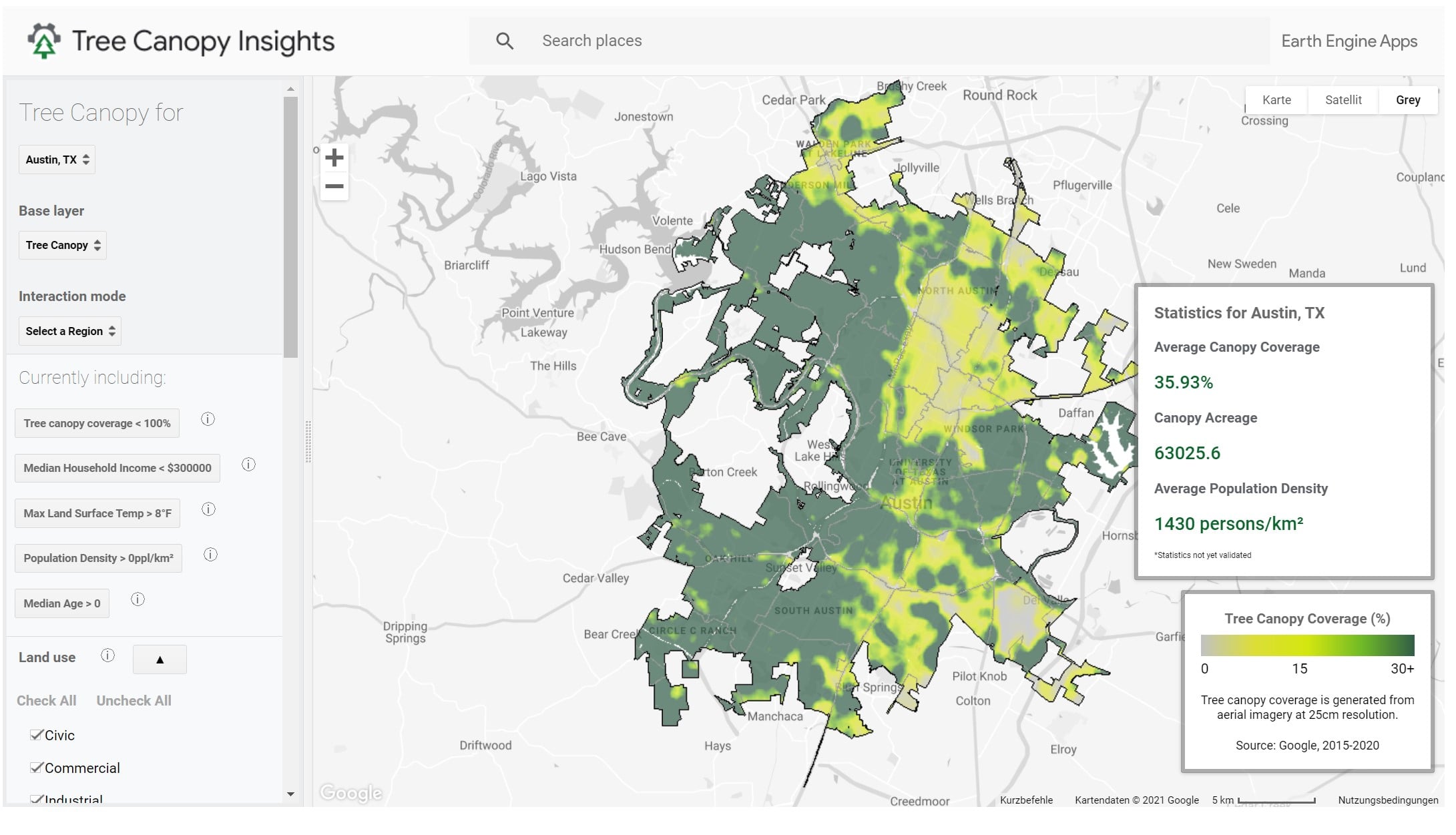
Determine new areas for tree planting efforts
Develop policies and processes that highlight areas of high need for trees based on population data and heat island risk, and develop long-term plans to plant more trees and ultimately reduce heat islands across cities.